Vindhya Range, the Hills That Ancient India Considered a Natural Border
Where the Vindhya Range Runs Across India
The Vindhya Range stretches across central India, running roughly 1,000 kilometers from Gujarat in the west to near Varanasi in the east. For centuries, these hills were seen as a natural line between northern India and the Deccan plateau further south. Ancient texts even described them as the southern boundary of Aryavarta, the early Indo-Aryan region.
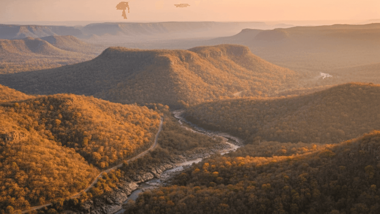
They are not towering mountains like the Himalayas. Most of the ridges sit between 300 and 650 meters high, forming wide plateaus and flat-topped hills made largely of sandstone.
Ancient India Saw It as a Natural Border
For a long time, the Vindhyas weren’t just hills on a map. They were considered a dividing line between northern plains and the southern plateau.
Dense forests once covered much of this region, and early travelers found the terrain difficult to cross. Historical texts describe tribal communities living in these forests, which made the region feel remote and mysterious to outsiders.
That idea stuck for centuries. Even today, people often refer to the Vindhyas as the symbolic divide between north and south India, though modern roads and railways cross them easily.
The Landscapes of Vindhyas
- Flat-topped sandstone hills that resemble layered platforms
- Deep river valleys carved by tributaries of the Ganga
- Forest zones around wildlife parks in central India
- Plateaus like the Rewa and Panna tablelands

Wildlife Parks and Natural Areas Nearby
Several protected forests sit along the Vindhyan plateau, which means travelers often experience the region through national parks rather than mountain treks.
Notable parks include Bandhavgarh National Park and Panna National Park. Both lie in landscapes shaped by Vindhyan hills and sandstone cliffs.
The forests here are home to tigers, leopards, sloth bears, and large herds of deer. Unlike Himalayan forests, these are dry deciduous landscapes with wide grasslands and rocky ridges.
Best Time to Visit
The Vindhyan region spans multiple states, but most travelers explore it through central India. October to March is usually the most comfortable period. Winter mornings are cool, afternoons are mild, and forest safaris are far easier without the intense summer heat.
Summer months from April to June can be extremely hot, though wildlife sightings sometimes improve because animals gather around shrinking water sources.
Weather Range
Weather varies depending on which part of the range you’re in, but the climate across central India is fairly predictable.
Winter temperatures often sit between 10°C and 25°C. Summers can climb beyond 40°C in exposed plateau regions.
Monsoon rains from June to September bring greenery to the forests and valleys, though travel becomes slower due to muddy roads and park closures.
How Many Days to Plan
The Vindhyas themselves aren’t a single tourist stop. They stretch across several states, so most travelers experience them through nearby destinations.
Two to four days works well if you’re combining wildlife parks, river valleys, and historical towns. Longer trips usually involve moving between multiple parks or plateau towns across Madhya Pradesh and neighboring regions.
How to Reach
Most routes into the Vindhyan region pass through central Indian cities. Rail connections through Jabalpur, Satna, and Rewa make access fairly easy. These cities sit close to the plateau and national parks.
For flights, Khajuraho and Jabalpur are common entry points before continuing by road.
Things Travelers Often Miss
- Plateau cliffs overlooking the Narmada valley
- Ancient rock shelters and cave sites in central India
- Small forest temples deep inside wildlife corridors
- Quiet sandstone viewpoints outside major parks
Few Tips that Come in Handy
- Book national park permits in advance during winter months
- Carry water during drives across plateau roads
- Mobile signal disappears quickly in forest zones
- Distances look short on maps but roads can be slow
Dos and Don’ts
- Respect wildlife park rules and stay inside designated safari routes
- Avoid feeding animals around forest lodges
- Dress in neutral colors for safaris
- Do not wander off marked trails in forest zones
Planning Insights
The Vindhya Range works best as part of a larger central India route. Travelers often combine it with heritage towns, temples, and wildlife parks spread across the plateau.
The landscape may look subtle at first glance. But once you notice the sandstone cliffs, wide valleys, and forest plateaus, it becomes clear why these hills shaped how ancient India understood its own geography.
Mistakes First-Time Visitors Make
- Expecting Himalayan-style mountains instead of plateaus
- Trying to cover multiple parks in a single short trip
- Ignoring travel time between towns in central India
- Visiting during peak summer without planning for heat.
If staying close to the Vindhya hills sounds appealing, Neomaxer helps travelers find well-located stays near it.