Mayodia Pass Offers One of Northeast India’s Most Scenic High-Altitude Drives
The road to Mayodia Pass disappears into fog long before you reach it. One moment you are driving through quiet forest, and the next, the world narrows to a strip of wet asphalt cutting through clouds.
Most Unique Drive in Mayodia Pass
Mayodia Pass sits above the town of Roing in the eastern Himalayas, inside the wild and sparsely populated stretches of Arunachal Pradesh. It rises to about 2,655 meters and forms part of the route connecting Roing to the remote districts deeper inside the mountains, including the vast and isolated Dibang Valley.
What makes this pass different is how quickly it transforms. The lower roads are warm, lined with bamboo and subtropical vegetation, but the climb brings pine forests, colder air, and heavy mist. It does not feel like a gradual ascent. It feels like crossing into another climate entirely within a couple of hours.
What the road feels like on the way up
The drive from Roing to Mayodia Pass is around 56 kilometers, but distance is not what defines it. The road curves constantly, with hairpin bends that force you to slow down and pay attention. On some turns, the valley drops sharply beside you, while on others, thick forest closes in so tightly that sunlight barely reaches the road.
There are long stretches where you won’t see another vehicle. The quiet becomes noticeable. Occasionally, clouds drift across the road, reducing visibility to just a few meters. It creates a strange sense of isolation, but also calm. This is one of those drives where the journey itself becomes the memory.
Best time to drive Mayodia Pass
- May to October offers the clearest views and safest road conditions
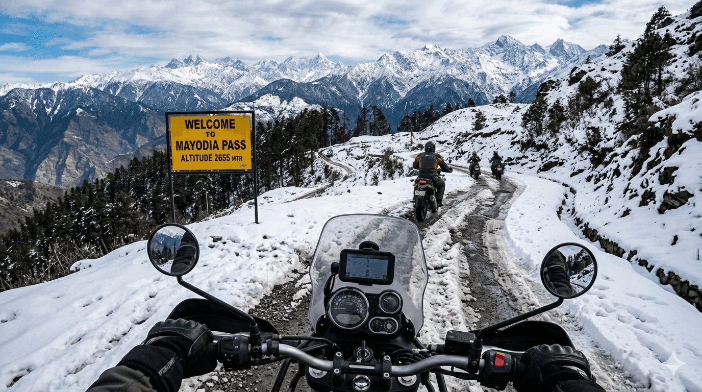
- Winter months from November to February bring snowfall, which makes the pass beautiful but harder to access
- Early mornings usually have better visibility before clouds gather
- Post-monsoon months like September and October have lush landscapes and fewer disruptions
- Heavy monsoon periods can cause landslides or roadblocks, so checking local conditions helps

How to reach Mayodia Pass from Roing and beyond
Roing is the main base for visiting Mayodia Pass. It is accessible by road from Tinsukia in neighboring Assam, which has the nearest railway station. From Tinsukia, the drive to Roing takes about 4 to 5 hours, crossing the Brahmaputra River and gradually entering hill terrain.
Once in Roing, the road to Mayodia Pass is direct. Most travelers hire local SUVs because drivers know how to handle the sharp bends and changing weather. The route continues beyond the pass toward Anini, but that section becomes more remote and requires careful planning.
What travellers should prepare before driving
- An Inner Line Permit is required for entering Arunachal Pradesh
- Fuel stations are limited, so filling up in Roing is essential
- Warm layers are necessary because temperatures drop quickly at higher altitude
- Offline maps help since mobile signal disappears on most of the route
- SUVs or vehicles with good ground clearance handle the terrain better
- Carrying snacks and water is useful because there are no shops on the pass
What makes Mayodia different from other Himalayan passes
Many mountain passes are known for dramatic peaks or extreme altitude. Mayodia is quieter and less exposed. It runs through dense forest rather than open rock faces, which makes the drive feel more enclosed and atmospheric.
The pass is part of the Mishmi Hills, a region known for its biodiversity. The forests here are thick and largely untouched. Even the air feels heavier with moisture, especially when clouds settle into the trees. This combination of forest, mist, and silence creates a very different experience from the barren high passes elsewhere in the Himalayas.
Stops worth making along the way
There are several natural viewpoints along the climb where the trees open just enough to reveal valleys stretching far into the distance. These spots are not marked, but drivers often recognize them and slow down. On clear days, you can see layers of hills fading into pale blue.
Near the top, snowfall in winter transforms the pass into a white landscape. Snow gathers on branches, roadside barriers, and even abandoned signboards. Travelers often stop here, step out briefly, and stand quietly in the cold air before the clouds move in again and erase the view completely.
If a high-altitude drive through misty pine forests sounds like your kind of trip, staying close to the action makes all the difference. Find handpicked mountain stays and plan your base easily with Neomaxer.